On May 23, the IMD provided a detailed update on X, stating, “Well-marked Low Pressure Area over westcentral & adjoining south Bay of Bengal moved northeastwards during past 12 hours and lay over the same area at 1730 IST of 23 May. Very likely to concentrate into a Depression over central parts of Bay of Bengal by morning of 24th May.”
The IMD further elaborated on the storm’s trajectory and intensity, noting, “Thereafter, to continue moving northeastwards, intensify further as cyclonic storm over eastcentral BOB by 25th May morning. Subsequently, it would move nearly northwards and reach near Bangladesh and adjoining West Bengal coasts by 26th May evening as a severe cyclonic storm.”
Impact and Preparations
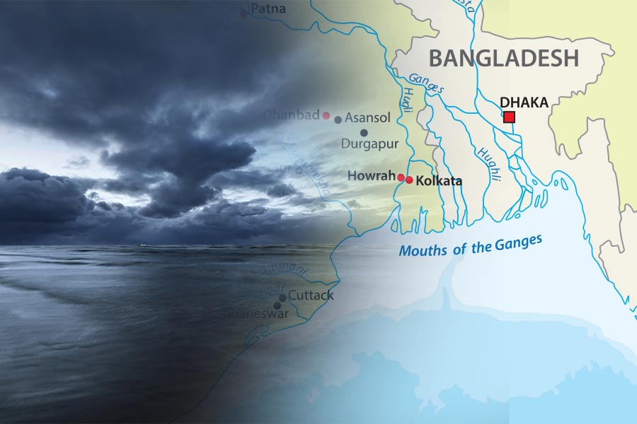
With Cyclone Remal expected to make landfall on May 26, authorities in both India and Bangladesh are gearing up for potential impacts. The severe cyclonic storm is anticipated to bring heavy rainfall, strong winds, and possible flooding to the affected regions. Coastal areas are likely to experience significant disruptions, and residents are being advised to take necessary precautions.
Precautionary Measures
- Evacuation Plans: Local authorities are preparing evacuation plans for residents in low-lying and vulnerable areas to ensure safety.
- Emergency Services: Emergency services are on high alert to respond to any incidents caused by the storm.
- Resource Allocation: Adequate resources, including food, water, and medical supplies, are being allocated to areas expected to be most affected.
Weather Forecast
The IMD will continue to monitor the storm’s progress and provide regular updates. As of now, Cyclone Remal is moving northeastwards and is expected to intensify further before reaching the coast.
Conclusion
Cyclone Remal is projected to make a significant impact as it approaches the coasts of West Bengal and Bangladesh. Residents are urged to stay informed through official channels and adhere to safety advisories issued by authorities. The IMD will continue to provide updates on the storm’s progression and potential impact.